6.6.2012 | 2 min Lesezeit
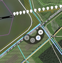
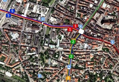
Bei der Bearbeitung von Vektormerkmalen in einer Web-GIS-Karte benötigt man oft Unterstützung für präzises Zeichnen. Das Einrasten auf bestehende Features von externen Daten (mit WFS oder anderen Vektorfeatures) war lange Zeit in OpenLayers Editor verfügbar, aber es fehlte noch fehlte jedoch die Unterstützung von Hilfslinien.
Wir freuen uns, Ihnen mitteilen zu können, dass Hilfslinien nun automatisch von OpenLayers Editor erzeugt werden können, während ein Feature gezeichnet wird. Hilfslinien bieten erstmals Unterstützung für das Zeichnen von rechtwinkligen Features oder von Features, die parallel zu anderen Features verlaufen."


_0.jpg&w=3840&q=75)