Digital, interactive maps have always been at the center of our activities. Even before Google Maps emerged, we produced the first web maps. With regard to the technologies used as well as the map content, we have continuously developed our products. As part of customer projects, we are constantly creating new, specialized maps for various topics and fields. In addition, we offer maps that are specially optimized for public transport and mobility using standardized services. In addition to top performance, these maps are always up-to-date. You can use these maps for your application even without your own server infrastructure.
Optimized for public transport
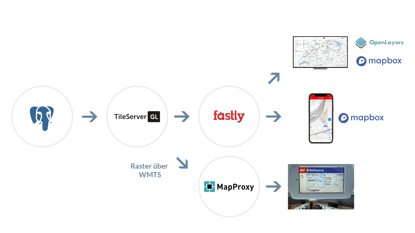
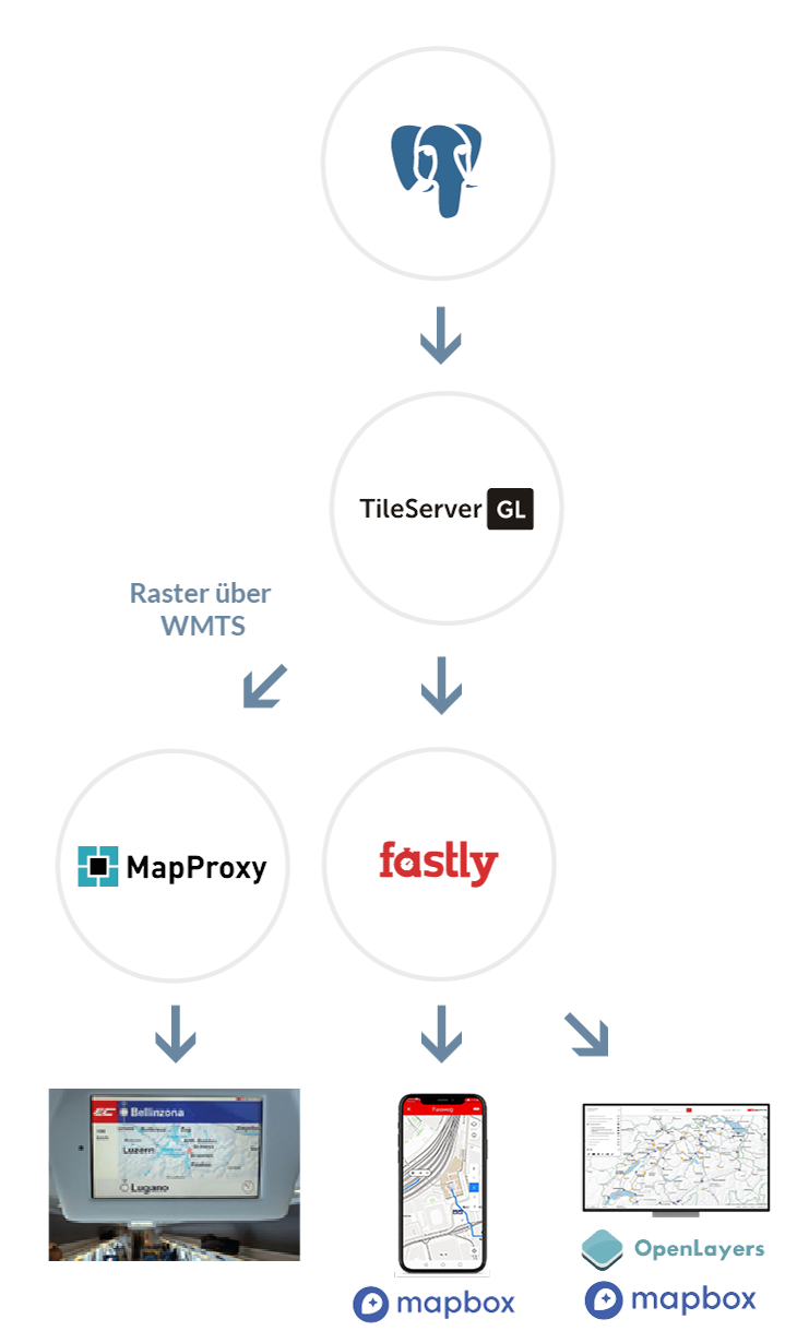
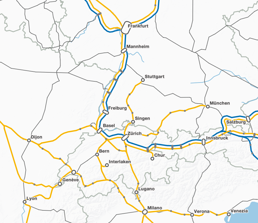
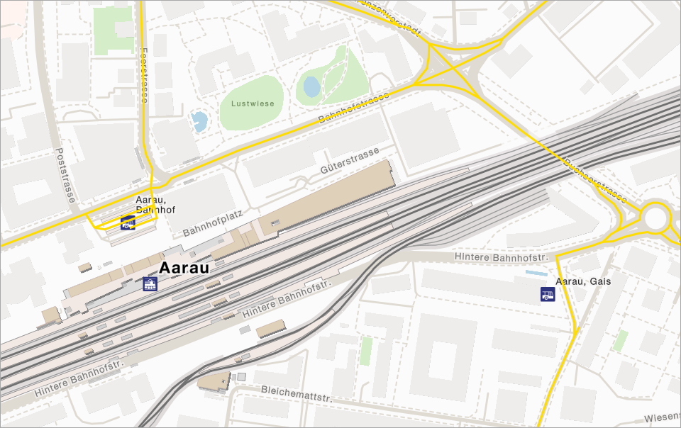
Our maps are based on the data of the free world map OpenStreetMap. This data is specially filtered in order extract the information essential to public transport and mobility in general. In addition, we integrate data from numerous, country-by-country or regionally available sources in order to expand the map content in a targeted manner with regard to the application focus.
In addition to a clear and informative design for general orientation, the following features distinguish our cards:
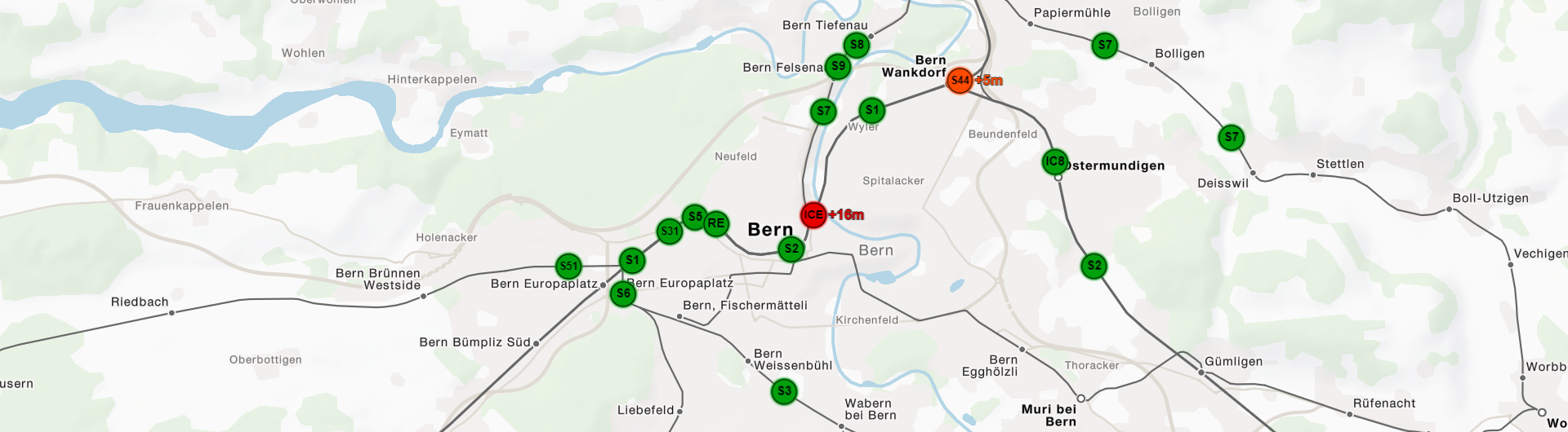
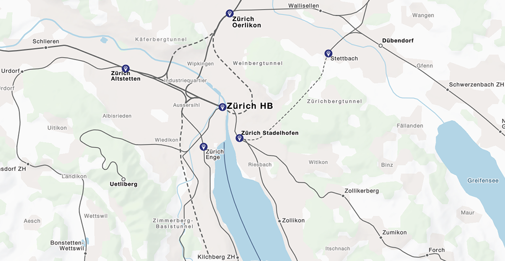
- Fully illustrated stations and stops with the official names and with the official numbering
- Stop edges as point objects as well as train, bus and tram platforms as surfaces - all with assignment to the correct stop
- Representation of the lines of public transport for trains, buses, trams and other means of transport
- Intelligent filtering of important lines for overviews in small scales (generalized display)
- Points of Interest (POIs) with the offers of Shared Mobility
- House numbers as well as entrances and passages as orientation points for door-to-door navigation
- Elements that are important for barrier-free navigation, such as lifts and escalators
Flexible with Vector Tiles
Our maps are based on MapBox Vector Tiles. This technology enables high-performance map visualization and enables unlimited possibilities for the styling and interactivity of the maps. Although using the same data source, the maps can look very different, for example when adapted to your corporate design or your special application.
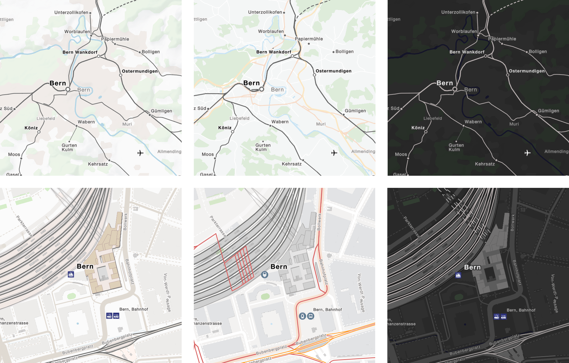
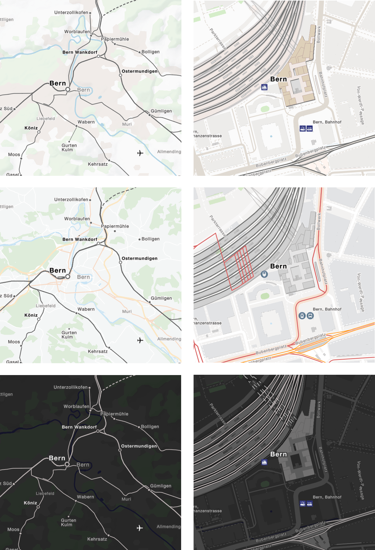
Safe and fast
We use an established workflow to deliver the maps to your application. Based on our database, in which the various data sources are integrated, Vector Tiles are calculated and processed for the Internet. All maps are available via a global content delivery network, which guarantees high transmission speed and low latency - no matter where in the world you use the maps. You can use the maps in your application with little programming effort using tried and tested software libraries. And should you require classic raster maps, they can also be provided in numerous variants.